Mohawk Lakes Trail, Colorado’s Best Alpine Lake Hike
If you are looking for a beautiful adventure, the Mohawk Lakes Trail, Colorado’s best alpine lake hike is perfect for you. 7 mountain lakes in one 8.5 mile hike. It is awesome. Read through to learn what to expect, trail tips, where to park, and more. In real life, this trail is prettier than the pictures in this post.
On a recent trip to Colorado, I had just one request: hike to at least 1 alpine lake. I’ve been asked “ocean or mountains” before. I used to say ocean until I spent time hiking and backpacking deep into the mountains and discovered their magic. But mountain lakes? Well, those are just a magical mix of water and peaks.
Alpine lakes are all unique. I’ve seen turquoise colored ones, glass calm ones that reflect the surrounding mountains, lakes that shimmer in the sunlight, and glacier lakes. I seek them out because I know I will always be awed by their beauty.
The Mohawk Lakes Trail takes you to 7 beautiful alpine lakes and a waterfall. You can’t really ask for much more in a day hike, especially when it’s only a 2 hour drive from Denver.
You’ll also find this hike on the list of Best Backpacking Trips in Colorado.
Mohawk Lakes Trail at a glance
Parking and Trailhead Info
Here is the googlemaps link to the trailhead on Spruce Creek Road. If you have a 4WD vehicle, you can continue past the main parking area and cut a couple miles off your hike. We enjoyed those miles through the forest, so if you have the time, I recommend hiking the whole trail.
If you’re coming from Breckenridge, take CO-9 S until Spruce Creek Road on your right. Parking is about a mile up the road; you can’t miss it, and the trail will be on your left. It’s around 2 hours from Denver.
Hiking the Mohawk Lakes Trail
Drive in to the parking area, and you will find the trail on the left. The trail starts with a 2 mile easy meandering through the woods. Don’t judge the trail based on the first 2 miles; it gets much, much better.
Once you cross a 4WD road, the trail starts to climb and you start to see what makes this trail so amazing.
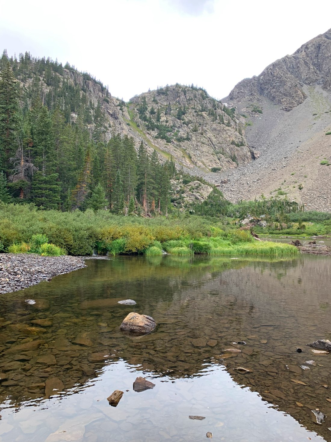
Around 2.5 miles in, you’ll pass a sign for Mayflower Lake (Lake #1), and I recommend taking the extra side trail to it.

Lake #1 – Mayflower Lake
Come back to the trail and follow the signs to Continental Falls and Mohawk Lake. You’ll pass old mining sites and forgotten cabins. Keep climbing and get a close look at the waterfall.
Once you hit 3 miles, you’ll see Lower Mohawk Lake. It is soooo pretty and provides a great view of Mount Helens. If you’ve brought a snack or lunch, this is a good spot to eat. Pack everything out with you, of course.
A lot of people hike to Lower Mohawk Lake and then turn around. Muster whatever energy you have left and keep going. The reward of the other lakes is SO worth it, and you’ll hopefully have the trail to yourself.
Mohawk Lake is 0.5 miles of steep climbing past Lower Mohawk Lake – go to the left and up. You feel like you’re going to stumble right into it because it’s at eye level when it comes into view. It’s the perfect glacier lake deep blue color.
This trail is called Mohawk Lakes, but the next 3 lakes are also awesome; they just don’t have names. Go see the unnamed lakes.
Other wonderful Colorado Hikes: Backpack Caribou Lake, Free Hikes near Longmont, or The Emerald Lake Trail in RMNP.
Lower Mohawk Lake and Mohawk Lake
Past the Mohawk Lakes
When we hiked this trail, I didn’t really think about the names of the lakes or which one we were admiring. I just loved them. If you make it to Mohawk Lake, you should keep going and see the unnamed lakes. The trail continues to be beautiful, isn’t that steep, and you might see some wildlife.
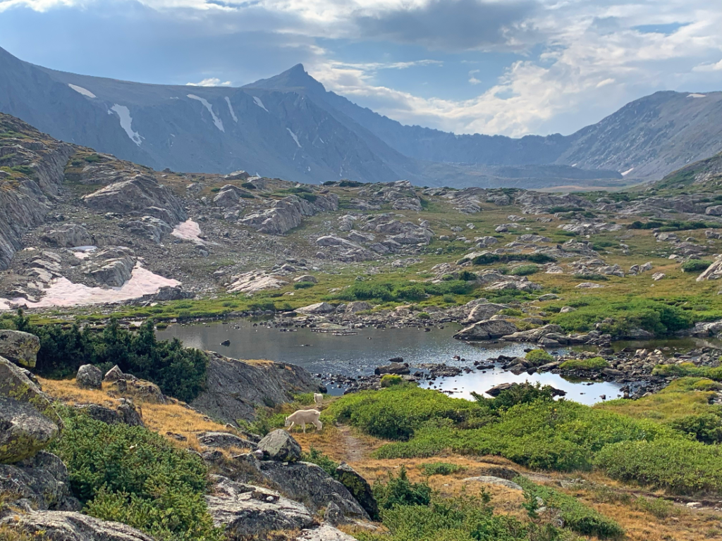
From looking at Mohawk Lake, head right and follow the trail to Lake #4. We saw a mom and baby mountain goat near this lake.

Lake #4 – see the mountain goats?
Go to the right around Lake #4 and continue on the trail. Some of the posts I read about this trail made it seem like there wasn’t a trail here, but we easily saw where we were supposed to go.
It’s a little further to Lake #5, 6, and 7. We ended up hiking around 9 miles total by going all the way to Lake #6. Lake 6 had an awesome mountain backdrop with shimmering water, so it’s definitely worth it. The trail isn’t as wide as other sections, but try not to veer off the trail to damage fragile ground.
Lake #5 and Lake #6
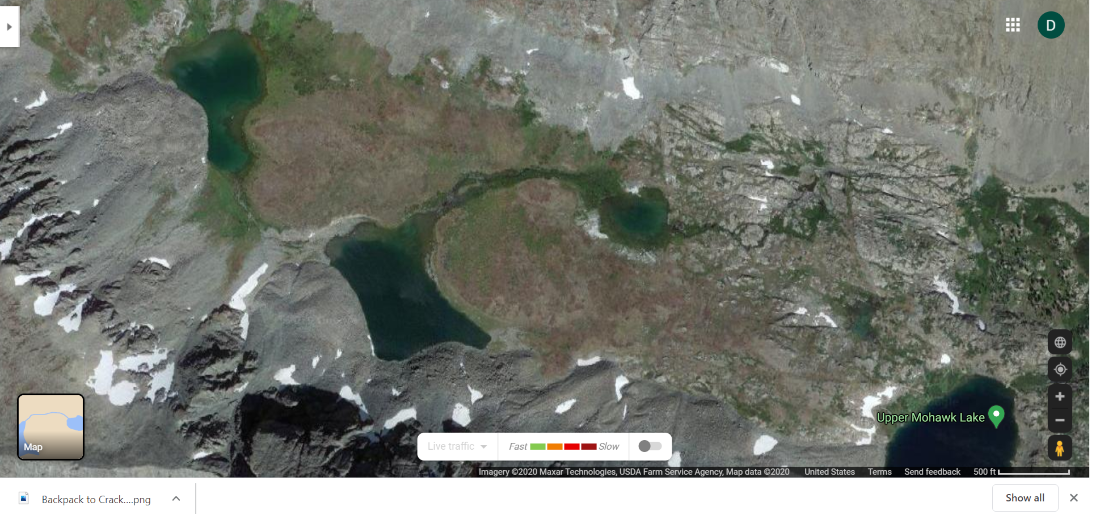
As I was writing this blog post, I discovered that we never made it to Lake #7. We used the AllTrails app to make sure we were going the right way, but we somehow thought Lake 6 was Lake 7 and turned around. If you look at the satellite googlemap below, you can see Upper Mohawk Lake, the little Lake 4 right past it, and then Lakes 5, 6, and 7. If you make it to 6, try to go all the way to 7 if you can. I will definitely be re-hiking this trail to see Lake 7.

Satellite image of the unnamed lakes – try to make it to the big one on the left
Advice/Thoughts
You will be in high elevation. This means the temperature can change drastically; bring layers. It also means the chance for altitude sickness. If you feel dizzy, nauseated, or hung over but not from alcohol, hike back down.
This trail can be steep at times, but not excessively. I never felt the need to use my hands, and I suck at steep hiking.
Leashed dogs are allowed.
Plan to hike early or later in the day to avoid crowds.
If you want to make a weekend of it, spend a night in Alma or Breckenridge and hike a 14er while you’re there.
I hope you enjoy the Mohawk Lakes Trail, best alpine lake hike in Colorado! Happy hiking!

Pin this for later!


you might consider undergoing the water blessing ritual here! We just simply need a break from routine in order to reconnect with ourselves in a completely different environment.